featured
Evaluating Benefits of Mitigation Strategies
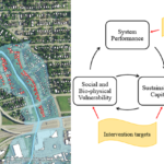
Dec. 13, 2018—In partnership with Nashville Metro Water Services (MWS), Dr. Camp and Dr. Katherine Nelson (graduate student at the time) performed a study of Nashville’s Home Buyout Program to remove homes from risk of flooding. Homes that had repetitive losses and were bought out were demolished with the area converted to greenspace. The project findings have...
Data Collection and Analysis to Evaluate Transportation System Performance
Dec. 3, 2018— Vanderbilt partnered with Tennessee State University to conduct a study for TDOT on the utilization and violation rates of Tennessee’s High Occupancy Vehicle (HOV) lanes. The study involved traffic counts, a public opinion survey, and analysis. Findings from the study were presented as both a poster and paper at the Transportation Research Board Annual...
Franklin and Murfreesboro Traffic Cameras Added to GIS Viewer
Nov. 5, 2012—Traffic cameras in Franklin and Murfreesboro were added to the GIS viewer today.
Truck Terminal and Corridor Performance Analysis
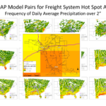
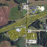
Oct. 8, 2012—Freight transportation planning is largely limited by the amount, quality and detail of truck trip data. Most truck movement data is reported at the inter-county level and is represented as aggregated tonnages that must be broken down to truck trips. Additionally, intra-county flows can be largely under-represented and commercially available commodity flow databases such as...
Mining AIS Data for Improved Vessel Trip Analysis Capabilities
Oct. 3, 2012—Introduction Automatic identification systems (AIS) provide communication between vessels and assist vessel traffic control functions in congested ports, locks and waterways. Vessels digitally broadcast information, including position, call sign, vessel name, course, speed, and navigation status. Publicly available waterway trip data is aggregated to protect business confidentiality of shippers. However, the level of aggregation renders...
U.S. Foreign Waterborne Cargo Data System: phase II
Oct. 3, 2012—Update This project was completed in February 2013. Relevant links for the completed research are below: Final report Final system In previous research projects completed for the Intermodal Freight Transportation Institute at the University of Memphis, Vanderbilt University researchers built a first-generation information system and international waterway network to support the analysis of cargo flows between...
Intermodal Freight Network – User Interface Development
Oct. 3, 2012—Update This project was completed in February 2013. Relevant links for the completed research are below: Final report Final system In previous research projects, Vanderbilt University created a first-generation intermodal freight transportation network using Geographic Information Systems (GIS) and researched means of performing terminal capacity estimation. These efforts resulted in a fully-routeable, nationwide network consisting...
