Zimmer-Dauphinee, J.; Wernke, S.A. “Semantic Segmentation and Classification of Active and Abandoned Agricultural Fields through Deep Learning in the Southern Peruvian Andes.” Remote Sensing, Volume 16, Issue 19, 2024, Article 3546, DOI: 10.3390/rs16193546.
In pre-Hispanic times, the Andean people built massive agricultural systems to support intensive farming in the challenging, mountainous regions of the Southern Peruvian Andes. However, many of these complex systems were abandoned after the 16th-century Spanish invasion due to various demographic, economic, and political crises. This study aims to understand how agriculture in the Andes expanded and declined over time by analyzing both active and abandoned farmlands using satellite images across 77,000 square kilometers of the region.
Traditionally, identifying these fields in satellite images is a slow, manual process. To speed this up, researchers used a deep learning technique called semantic segmentation, which can automatically detect and classify agricultural infrastructure in the images. They first created a training dataset by manually identifying sample areas and then used it to train a neural network model. When comparing the results to manual surveys, the deep learning model proved to be more efficient and accurate at mapping large areas of Andean agricultural land. This approach provides a better way to study and document ancient farming systems on a large scale.
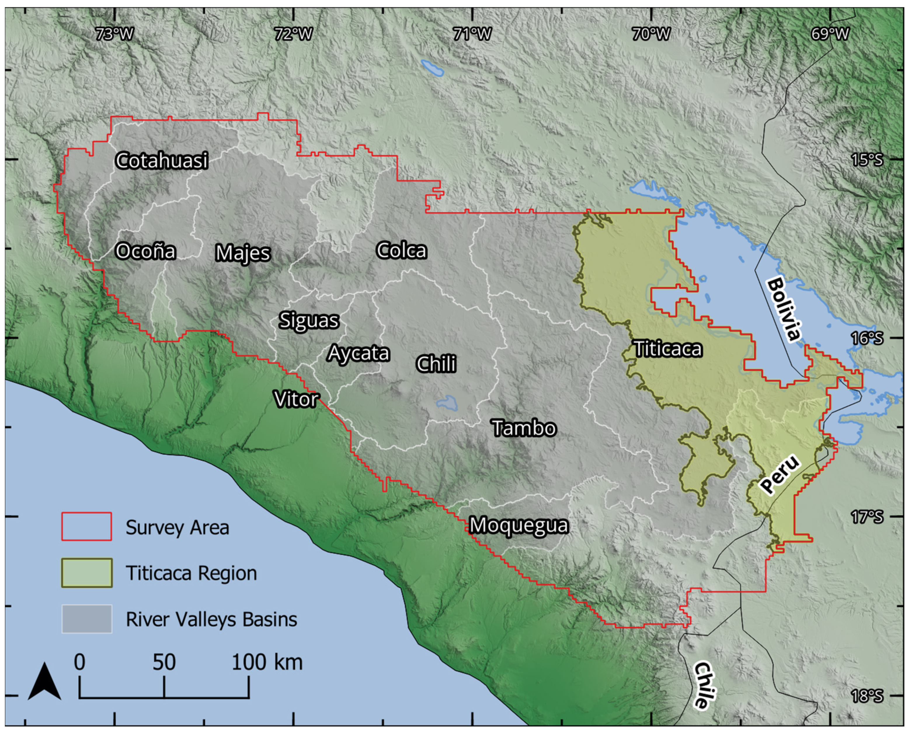
Figure 1. Map of the survey region, including a boundary outlining the Titicaca region as defined for this study. 